
OpenOrienteering is a project developing a collection of tools which help with the creation of orienteering maps and the organization of orienteering events.
Posted on 08 March 2012 by Thomas Schöps
Today comes just a short progress report to show that we are still alive ;-) Development is currently going on slower than before, but apart from the usual bugfixes and smaller improvements some features have been added since the last update nevertheless. These are:
The cut tool to split lines in two, remove segments from lines or cut areas into two parts
The ‘cut hole’ tool to cut holes into areas
Translation infrastructure and German translation covering most of the currently existing texts, contributed by Kai Pastor
Posted on 21 February 2012 by Thomas Schöps
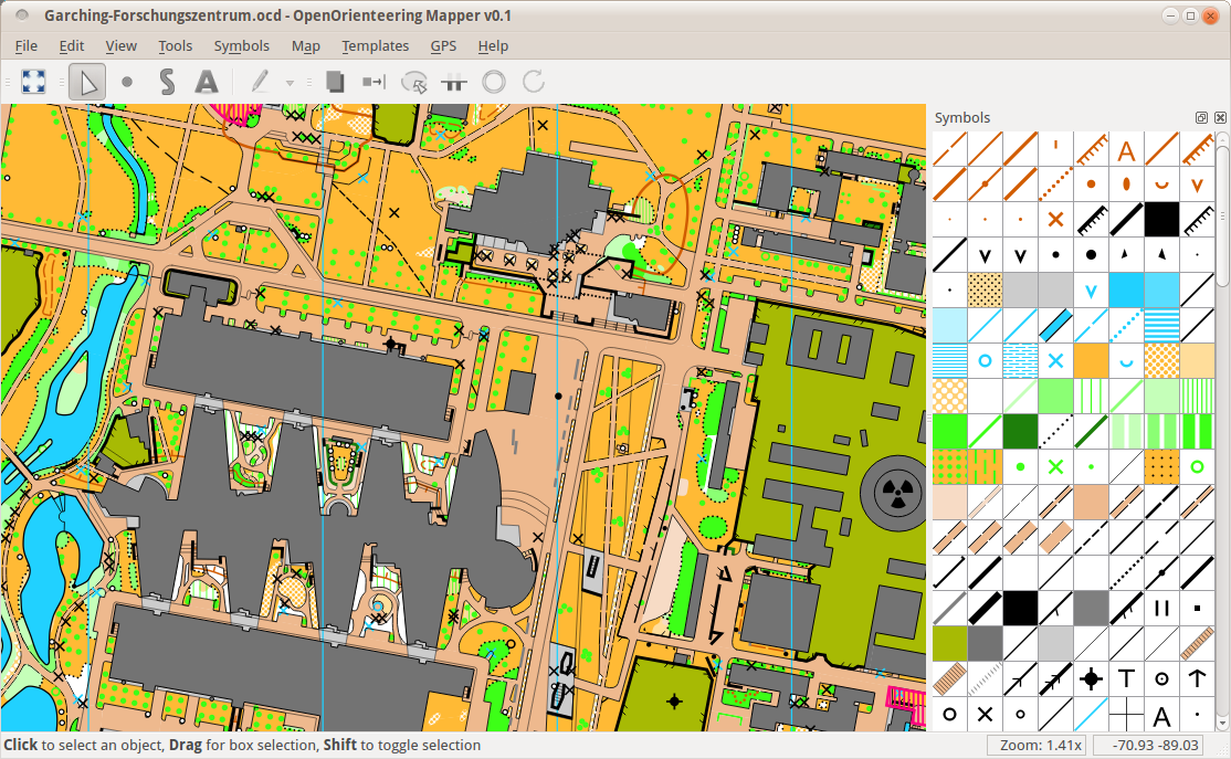
Since the release of the alpha version of OpenOrienteering Mapper some progress was made, so it is time again to present the latest advances. One thing I’m particularly happy about is that various developers already contributed patches to the program. Most notably Pete Curtis joined the project and has been doing great work on file import/export. This of course includes the most requested feature, conversion to and from ocd files (currently, version 7/8 only). You can see a work-in-progress screenshot of the ocd import here:
Other than that, work is going on to implement the essential map edit operations. Since the release of the first alpha version, the following features have been added:
Writing and editing text objects
Adding / Removing points from paths with the edit tool
The rotate tool
The path connect tool
And, of course, a lot of bugs have been fixed. The release of the next alpha version is planned when ocd import (and maybe export) are working well.
Posted on 10 February 2012 by Thomas Schöps
What is OpenOrienteering Mapper? OpenOrienteering Mapper is an open source cartography program which is specially aimed at drawing orienteering maps. It is intended as a free alternative to the current standard program for this task, OCAD. Its main advantages compared to it are:
Open Source: the program is completely free and I will never demand money for it. Every programmer can improve it.
Cross-platform: the program currently works on Windows, Mac OS X and Linux. An Android version is planned.
Status I am happy to announce the release of the first alpha version today. This version is primarily intended for interested developers and adventurous users who like to try new stuff and give feedback. Though it would be possible to draw most parts of an orienteering map with this alpha version, many comfort functions are missing and the program has not been tested extensively, so I do not recommend to start any mapping projects with it yet.
Download
Binaries for Windows: Mapper-alpha1.zip
Binaries for Mac OS X: Mapper-alpha1-mac.zip
Source for Windows and Linux: Mapper-alpha1-src.tar.gz
Screenshots
(Download map file, sample 600 dpi image export, sample pdf export)
Current feature overview
Definition of all symbol types relevant for orienteering maps: point, line, area, text and combined symbols
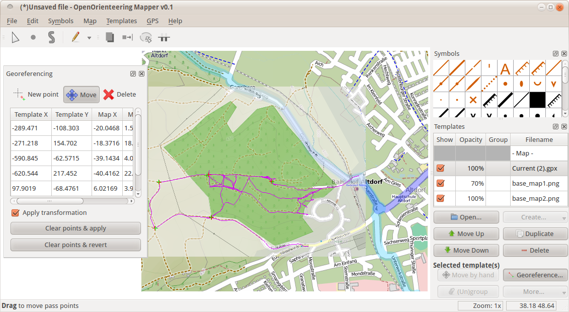
Loading and georeferencing of raster image and gpx track templates
Basic drawing and editing tools for points and paths (lines, areas and combined symbols) with live preview
Map printing, direct PDF and raster image export
Comes with ISOM 2000 foot-o symbol set (except overprinting symbols)
Plans The next goal will be to reach a state where the program can be recommended for mapping projects. I will probably release updated alpha versions from time to time. As soon as this is done, I plan to attempt the Android port, which should get an adapted user interface and make use of digital compasses and GPS devices.
You can find a detailed roadmap here. There is also a lengthy design document which describes some parts of the planned user interface of the desktop version.
Contributing If you like the project, you are welcome to contribute to it. Up to now, I worked on the project alone, but there is a lot to do and I’d appreciate any help. You do not need to be a programmer to help! Here are some ideas:
If you are not a programmer …
Try the alpha version and give feedback. Report any bugs you find to the bug tracker. Please make sure that the bug you report does not exist already. Currently the tracker contains all known bugs and the features planned for the first milestone.
Complete the symbol sets that come with the program. Currently there is only a (big) part of the ISOM 2000 symbol set. Suggestions are to complete this set, have a look at its color priorities and possibly suggest enhancements, to build the ISSOM 2007 sprint symbol set, or to build a school-o symbol set.
Write general documentation, “tips of the day”, or the in-application help.
Spread the word!
If you are a programmer …
The program is implemented in C++ using Qt. You can get the latest source from the git repository like this:
git clone git://git.code.sf.net/p/oorienteering/code oo-mapper
Again, some ideas:
Pick any item from the bug tracker.
Evaluate the Necessitas (Qt on Android) project, design and implement a mobile user interface for Android.
Or anything else that you find useful ;-)
In any case, be sure to send me an e-mail or leave a comment here in case you want to contribute!
If you want to stay updated on new developments, I recommend to check back here regularly or to read the RSS feed.
Posted on 05 February 2012 by Thomas Schöps
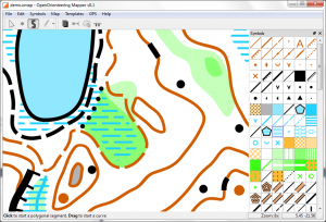
In the meantime I built the ISOM 2000 foot-o symbol set in OpenOrienteering Mapper, except the overprinting symbols, because there is no course setting support planned for the near future (I recommend Purple Pen for that task). All of the symbols should display correctly, apart from any mistakes. Working with the program to create the symbol set allowed me to find and fix a lot of bugs and usability problems.
In addition to that, it is now possible to draw point and path objects on the map and there is a basic edit tool to adjust their control points. All of the tools show a neat live preview of the objects that are drawn. You will soon be able to try it yourself easily because I plan to release a first preview version for Windows the next days (well, I think that I should at least try to counteract the announcement of the OCAD 11 beta a bit ;-) ). There are only a few things missing that I want to add beforehand. For now, here are two screenshots:
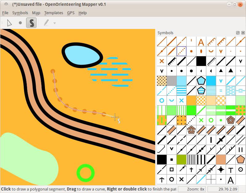
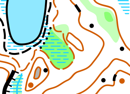
Posted on 30 January 2012 by Thomas Schöps
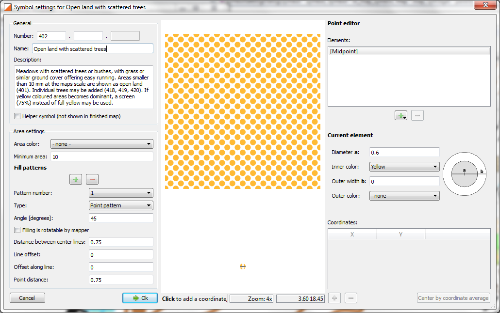
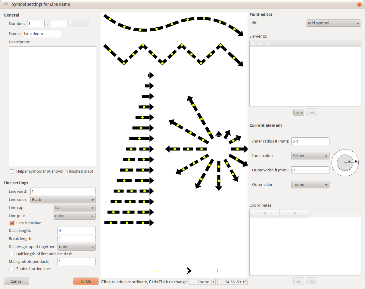
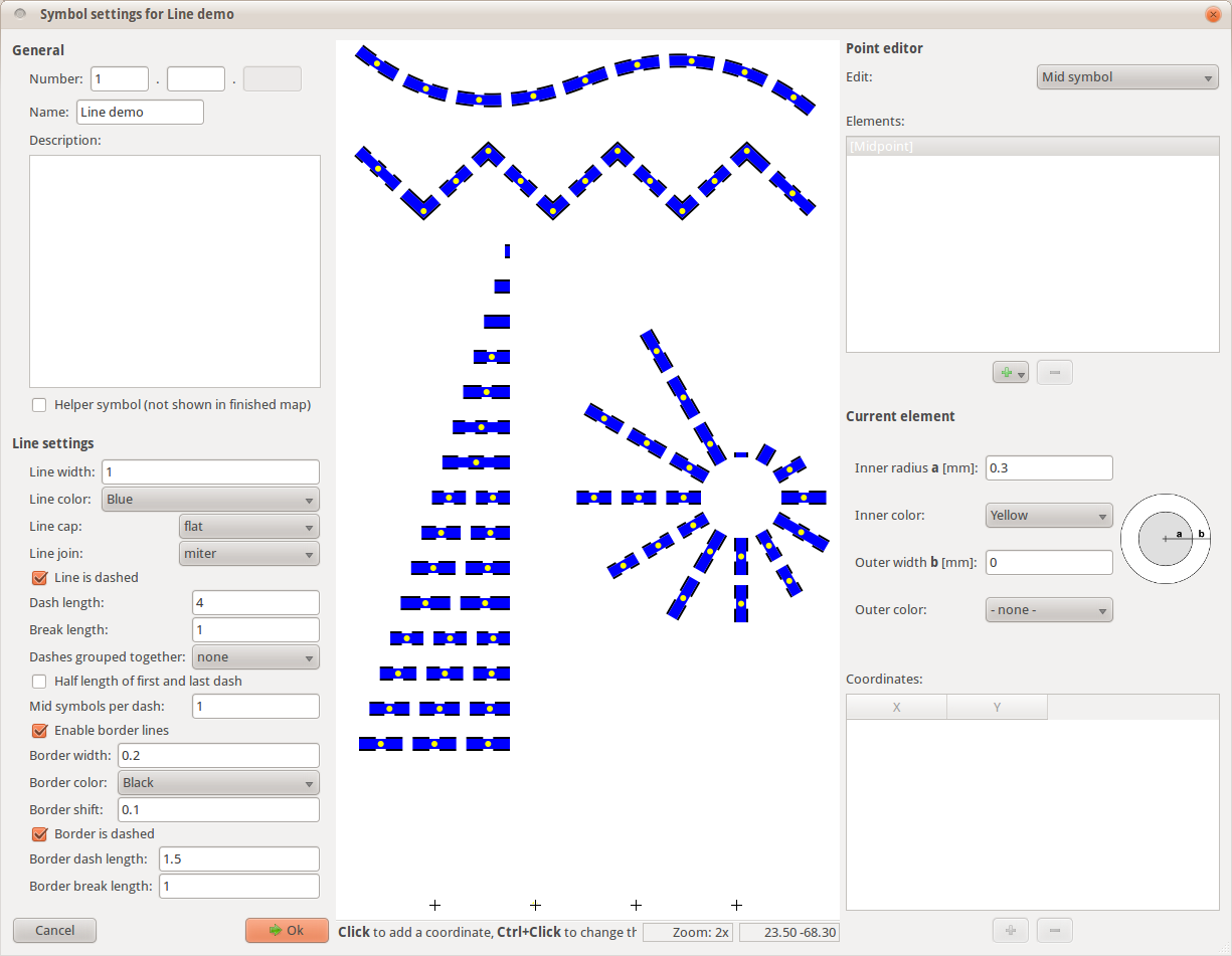
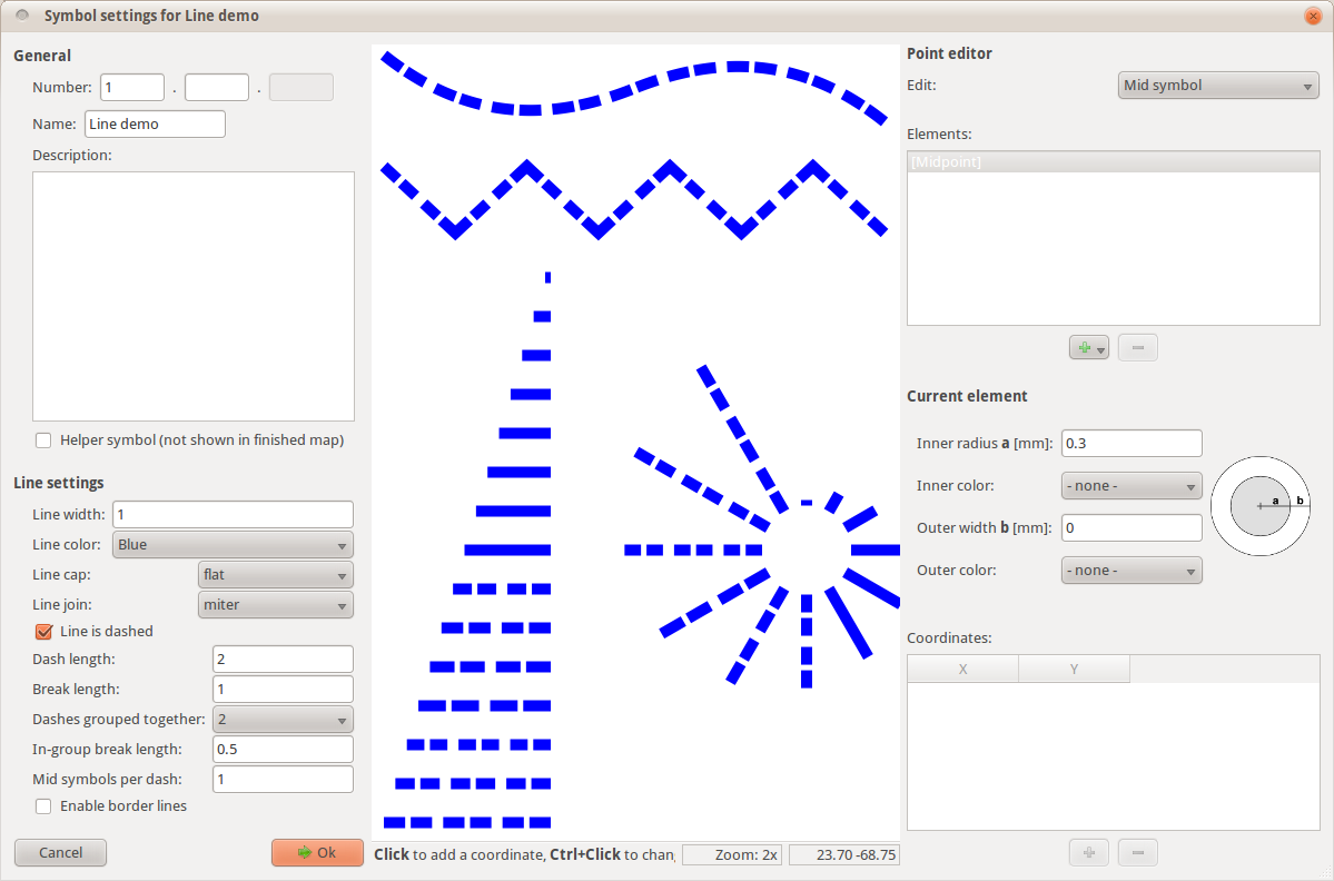
Initial support for line symbols is now finished. In theory, all types of lines described in the orienteering map standards should be supported. On the other hand, there are still some possible setting combinations which do not give sensible results. Here are a few screenshots showing different possibilities:
One thing to note about the line symbols is that the orienteering map standards just specify ‘ideal’ lengths for the dashes and breaks of the line types. There are no recommendations for how to handle the case where these ideal lengths do not add up to fill a line exactly. The simplest way would be to use the ideal dash and break lengths and just cut the line off where it ends. This will look bad at one line end in the most cases, so a solution which scales the dashes and/or breaks to fit into the line should be preferred.
OpenOrienteering Mapper currently does it like this:
Only dashes are scaled, the breaks are always of the same (ideal) length.
When a dashed line segment is created, to determine the number of dashes to show, first the dash counts for the two ideal line lengths which are closest to its actual length are calculated. From this, the deviation of the ideal length of the dashes themselves when scaled into the real line is calculated for the two possibilities and the number of dashes where this deviation is smaller is chosen. In other words, when determining the number of dashes for a line, the program tries to minimize the deviation from the ideal dash length.
Special case: if the length of the segment in question is smaller than the length of the ideal segment with two dashes (or dash groups) minus the maximum amount of deviation from the ideal dash length (calculated from the point where the dash (group) count switches from two to three) for every dash, the line is considered too short for dashes and displayed as a continuous line.
This seems to look okay in most cases (as can be seen in the screenshots above). But in the case where multiple dashes are grouped together (with the intent of having a different break length inside groups than outside), the length of the line it takes until the dashes show up feels rather long, as can be seen here:
This of course assumes that the system works correctly, which I am not completely sure about ;-) It would be possible to specify an arbitrarily lower limit for the dashes of lines with dash groups. But that is the problem I see with it: it would be arbitrary.
Does this system sound reasonable? Do you have any ideas for improving it? Feel free to leave a comment.


