OpenOrienteering is a project developing a collection of tools which help with the creation of orienteering maps and the organization of orienteering events.
Posted on 02 August 2016 by Kai Pastor
Mapper v0.6.4 brings bugfixes and improvements. It contains 170 commits since 0.6.3, changing 129 source files. The most important changes are:
Note that this release does not yet include GDAL-based importers. This work-in-progress remains available with the “unstable” builds.
Find all resoved issues on Github. Known issues in 0.6.4 will be collected there, too.
Thanks to all the contributors! An explicit “Thank you!” goes to Weblate which now hosts our translations and makes it easy to contribute online. See our wiki for more information on translation.
Posted on 18 June 2016 by Kai Pastor
Mapper v0.6.3 is a bugfix release. It contains 33 commits since 0.6.1, changing 46 files. The most important changes are:
Note that this release does not yet include GDAL-based importers. This work-in-progress remains available with the “unstable” builds.
Find all resoved issues on Github. Known issues in 0.6.3 will be collected there, too.
Thanks to all the contributors!
Posted on 29 May 2016 by Kai Pastor
Mapper v0.6.2 brings bugfixes and improvement. It contains 205 commits since 0.6.1, changing 277 files. We want to highlight the following additions:
Note that this release does not yet include GDAL-based importers. This work-in-progress remains available with the “unstable” builds.
Find all resoved issues on Github. Known issues in 0.6.2 will be collected there, too.
Thanks to all the contributors!
Posted on 28 January 2016 by Kai Pastor
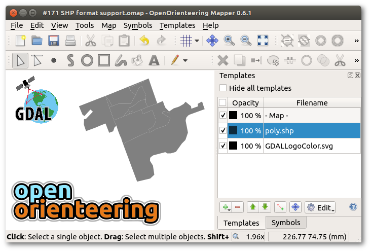
We are adding GDAL, the Geospatial Data Abstraction Library, to the components of OpenOrienteering Mapper. GDAL is an open source translator library for raster and vector geospatial data formats. We identified a number of feature and change requests which will benefit from using GDAL.
It will take a while to materialize, but the implementation of a template class which loads geospatial vector data through GDAL/OGR is already working very well. The supported formats include DXF, Shapefiles, and many more. In contrast to existing implementation, the new template class can preserve style information e.g. in DXF files.
The current unstable snapshot comes with GDAL 2.0.1 for Windows, and it uses the distributions’ packages on Linux. (There is no GDAL support for openSUSE 13.2).
Posted on 10 January 2016 by Kai Pastor
With Mapper v0.6.1, we offer the following new translations:
In total, there are now 15 languages which you can choose for the user interface.
The new release has fixes for minor issues in the program and in the documentation. Mapper v0.6.1 contains 40 commits since 0.6.0, changing 48 files.
Find all resoved issues on Github. Known issues in 0.6.1 will be collected there, too.
Thanks to all the contributors!